Redefining Seabed Intelligence
Advanced autonomous vehicles and data platform transforming how the world maps, monitors, and understands the seafloor.
Ocean Data, Faster
Our vertically integrated approach – custom AUVs, and cloud-native platform - delivers mission-critical advantages.
Rapid Actionable Insights
Onboard edge computing unlocks QA/QC and performance monitoring during data acquisition, delivering key insights to stakeholders without requiring AUV recovery.
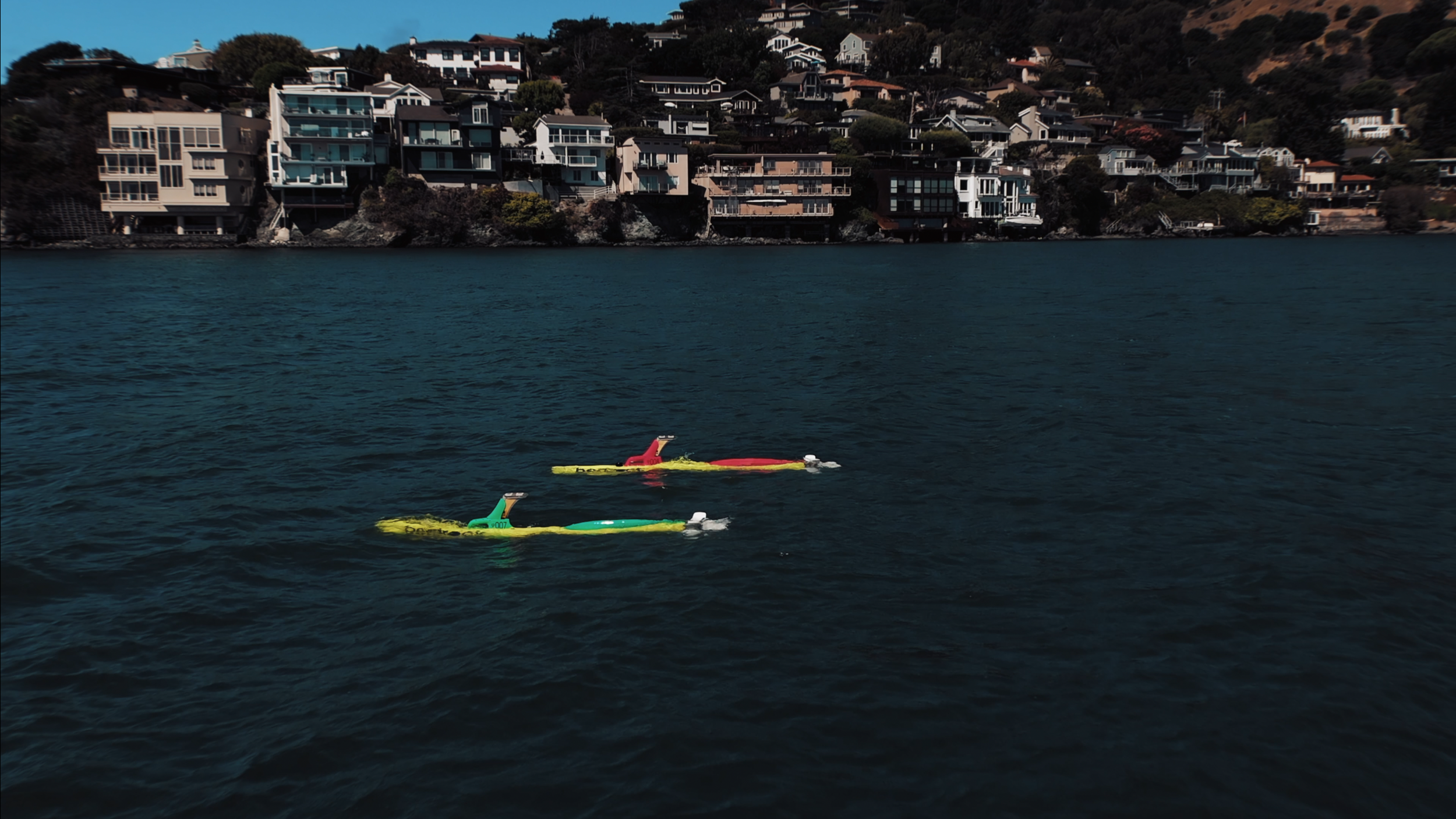
Any Vessel, Anywhere
Launch from any vessel, anywhere. Leverage your existing assets with no specialized gear, turning your vessel into a force multiplier -unlocking standby value and enabling multi-use.
Mobilize on Your Schedule
Our regional flexibility and low logistics design enables rapid response to weather, ship schedules, and dependable availability in partnership.
Data For Critical Infrastructure
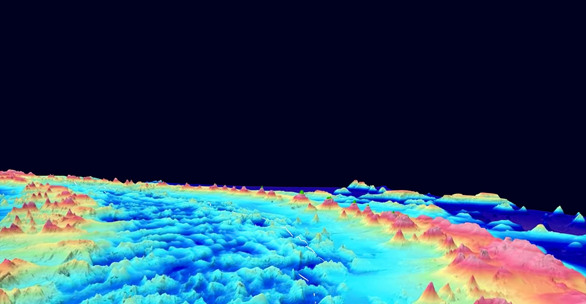
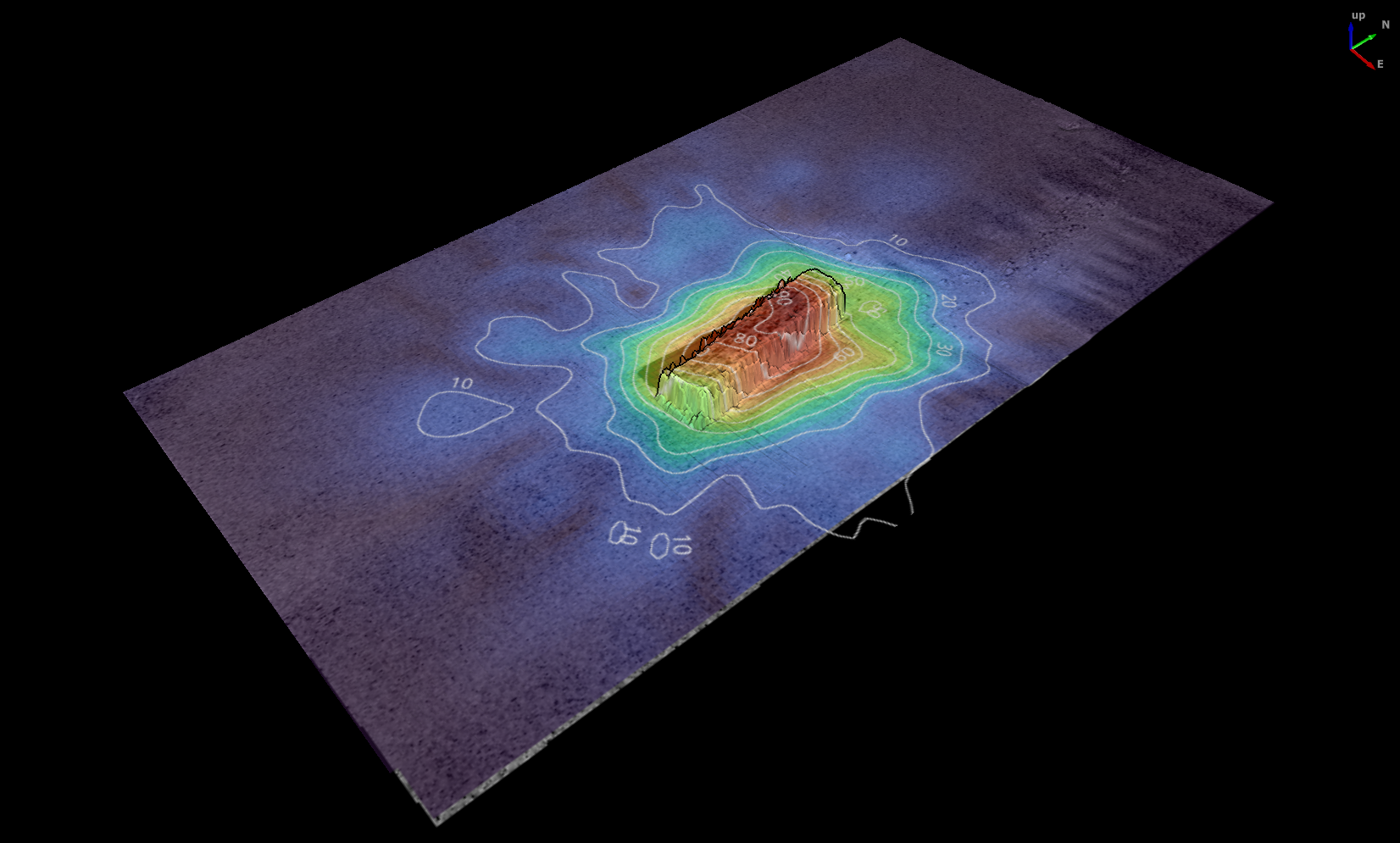
Bedrock delivers high resolution geophysical survey data that meets stringent IHO special order standards. View our full technical specifications here


Multibeam Echosounder
MBES
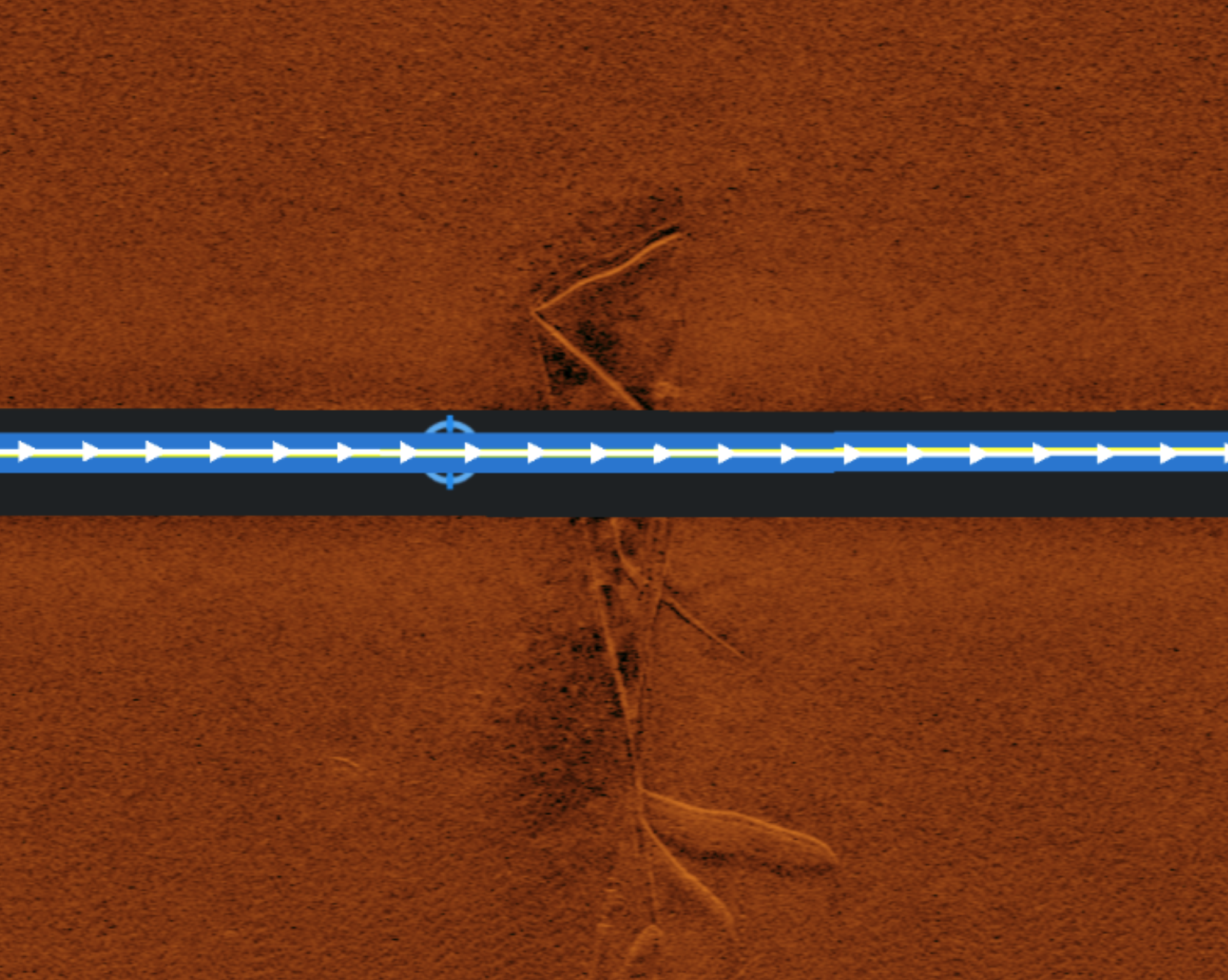
SSS
Side-Scan Sonar


Magnetometer
MAG
SBP
Sub Bottom Profiler
Supporting Critical Ocean Infrastructure and Industries
-
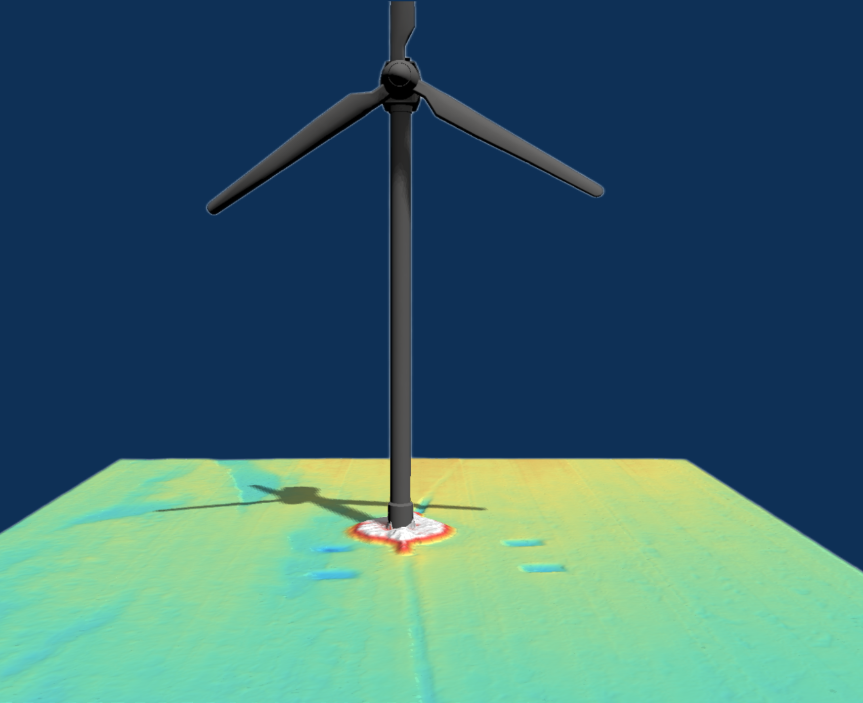
Energy development depends on accurate seabed intelligence throughout the lifecycle of offshore infrastructure. Bedrock’s rapidly deployable AUV systems support offshore wind, oil and gas, and emerging renewable projects by providing high-resolution mapping for site characterization, installation planning, and ongoing monitoring.
Because our systems can mobilize quickly and deploy from locally available vessels, operators can collect new data whenever project needs evolve. This enables faster cable routing assessments, foundation verification, and infrastructure monitoring across both traditional energy assets and next-generation offshore developments.
-
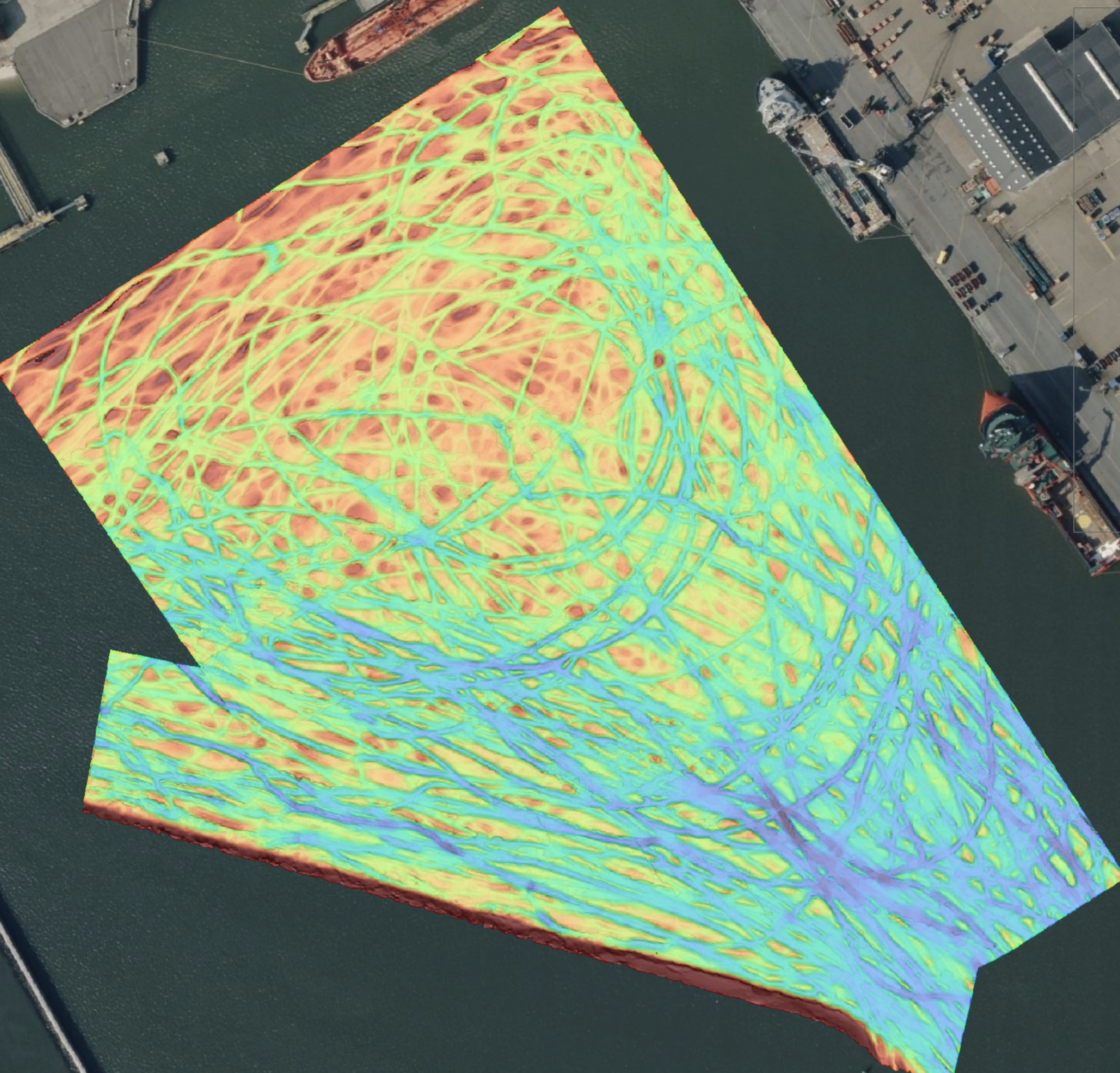
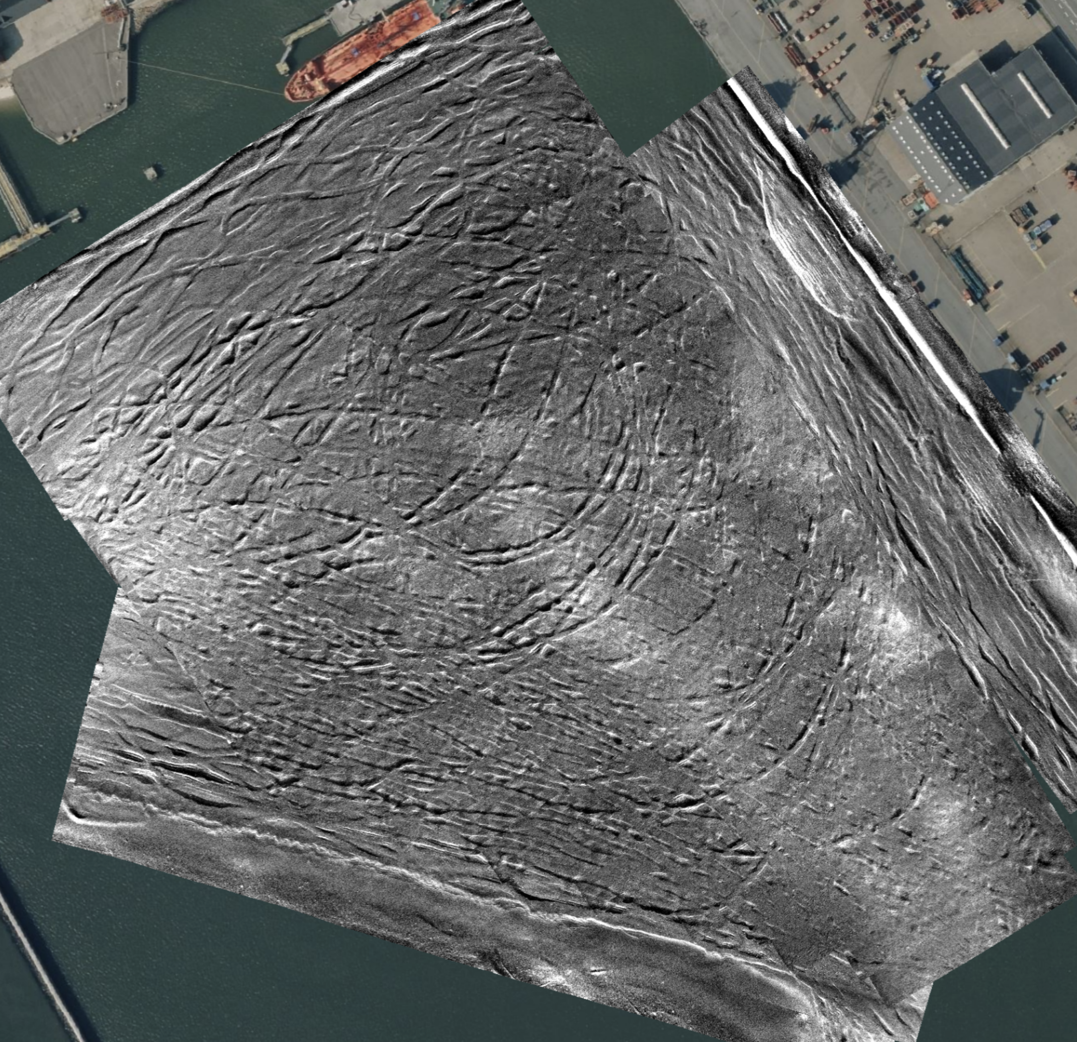
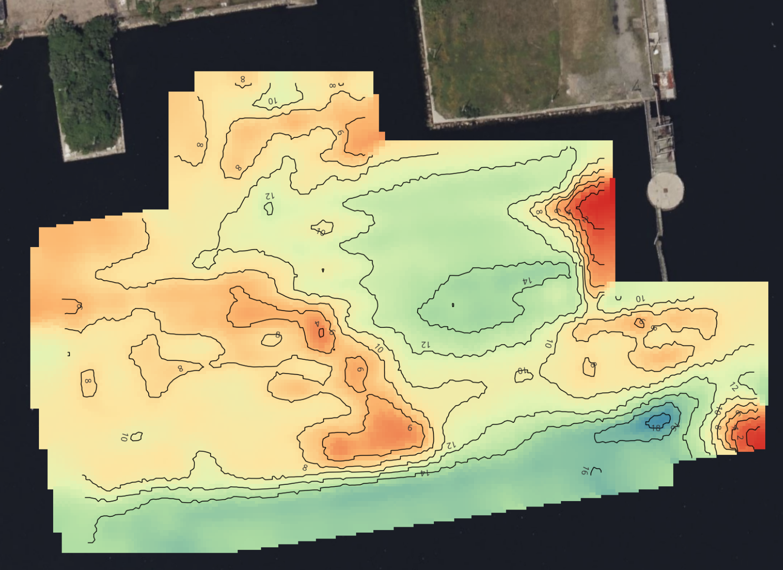
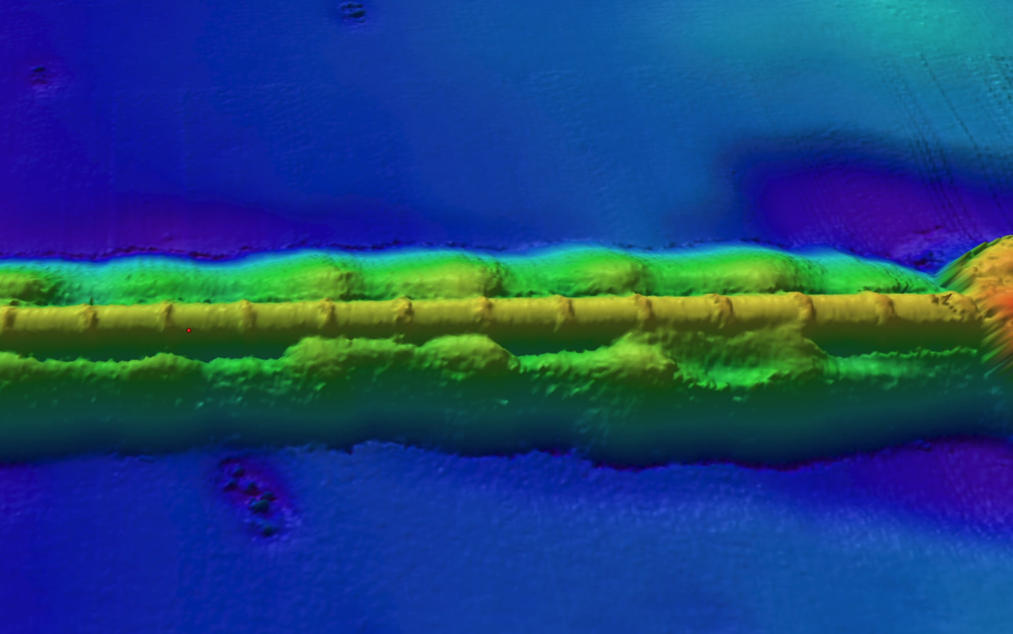
Operators of critical maritime infrastructure rely on consistent seabed awareness to maintain safe and efficient operations. Bedrock’s AUV platform enables high-resolution surveys for ports and harbors, submarine telecommunications networks, and other subsea infrastructure where regular monitoring and change detection are essential.
By operating safely beneath the surface and deploying from locally available vessels, our systems can collect detailed terrain data without disrupting port traffic or marine activity. This allows infrastructure owners to detect seabed change, monitor sediment movement, inspect assets, and maintain reliable operations across complex coastal environments.
-
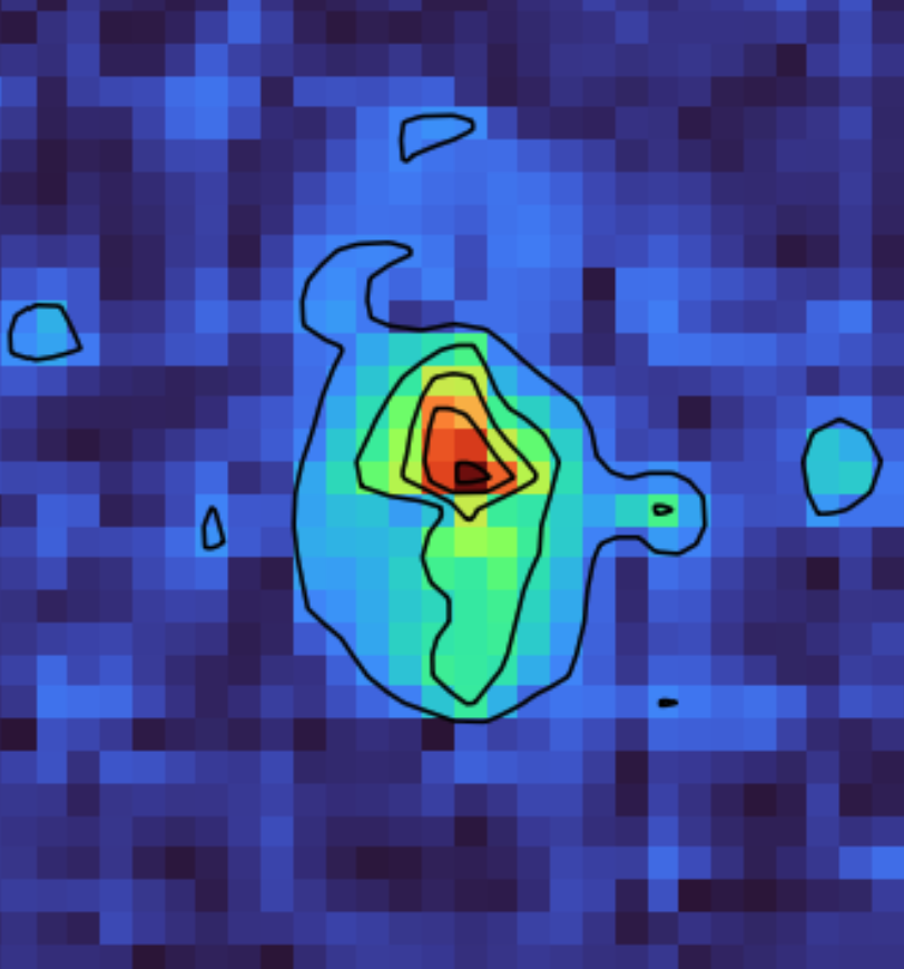
Security and defense organizations require reliable seabed intelligence to support marine domain awareness and protect critical underwater infrastructure. Bedrock’s AUV systems enable repeatable, high-resolution surveys that establish baseline seabed conditions and detect changes over time.
Operating below the surface and with a minimal operational footprint, AUVs can collect data discreetly in sensitive maritime environments. This supports safe vessel navigation, environmental characterization, and monitoring of strategic waterways and subsea assets.
-
Scientific discovery depends on accessible, high-quality seafloor data. Bedrock partners with research institutions to expand ocean mapping efforts, support new sensor development, and test emerging subsea technologies.
By enabling flexible deployments from locally available vessels, our platform allows researchers to gather detailed seabed data more frequently and in more locations. These collaborations contribute to broader global mapping initiatives and help make ocean intelligence more accessible to the scientific community.