A new era of ocean mapping services.
Our vertically-integrated platform gives us complete control of the data collection process, allowing us to tailor our solutions to meet your specific surveying needs.


Energy & Infrastructure
Reconnaissance & Site Investigation
Pre-construction Surveys
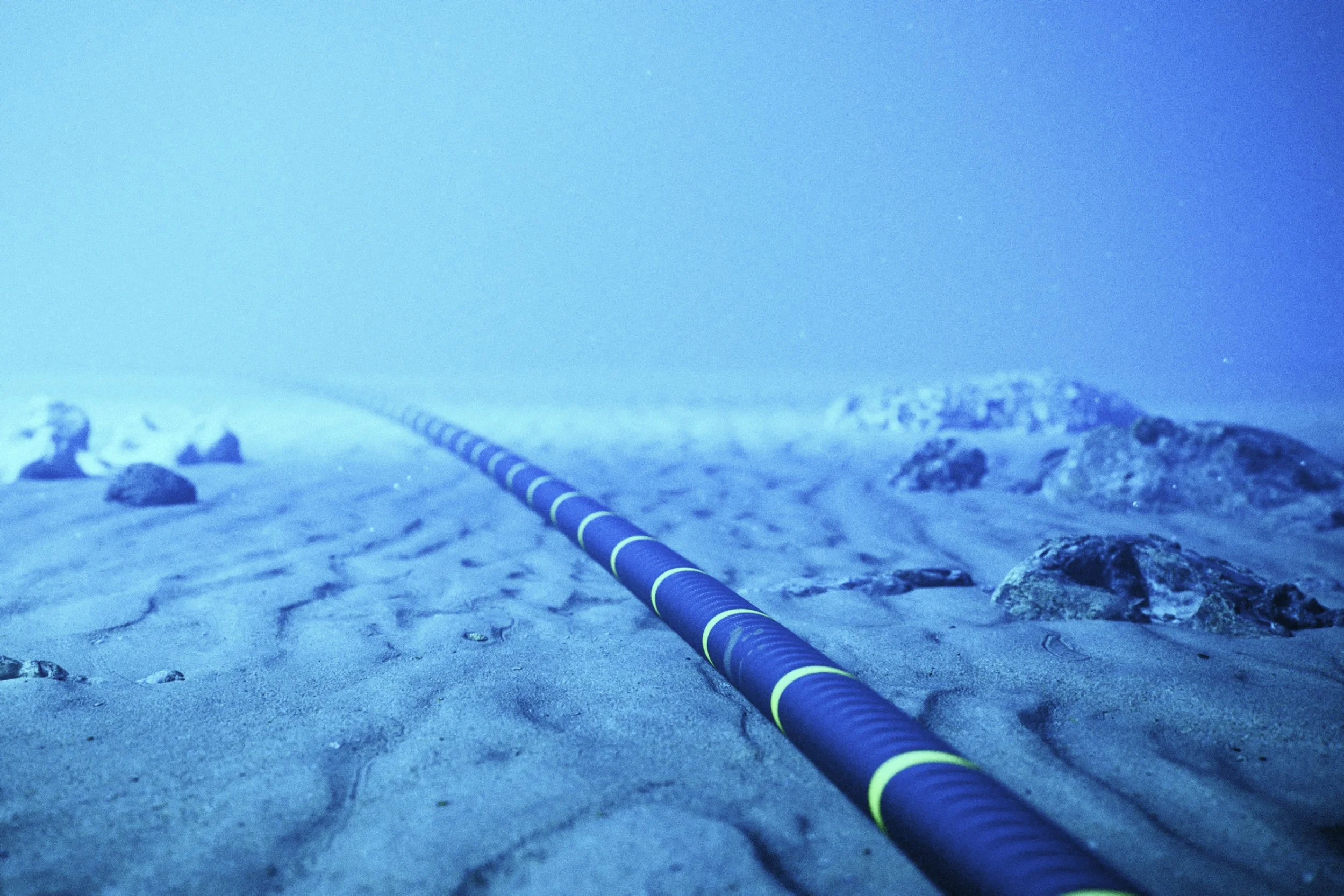
Export & Inter-array Cable Surveys
Operations & Maintenance
Pipeline Inspections
Decommissioning

Marine Research
Maritime Archaeology
Environmental Surveying
Seabed mobility
Coastal Resilience
Maritime Security
Mine Countermeasures (MCM)
Intelligence, Surveillance and Reconnaissance (ISR)
Port and Critical Infrastructure Monitoring
Rapid Environmental Assessment (REA)
Search and Rescue Operations (SAR)
Advantages of the Bedrock Platform
Less time spent on permitting.
We save months of permitting time and expenses. With our AUVs, there is no danger to the safety of navigation at sea. We minimize the impact on ocean life and eliminate the risk of asset damage with smaller, less powerful sonars. As a result we are exempt from needing ITAs or PSOs to operate.
Faster to mobilize and transportable by air.
We can mobilize our vehicles in days. The entire AUV fits in two cases and we have specialized Li-ion battery logistics partners. No ITAR restrictions.
100% electric and green.
All our vehicles are fully electric, powered by Li-ion batteries. We purpose-built a sustainable system for a sustainable future.
Consistent data of the best quality
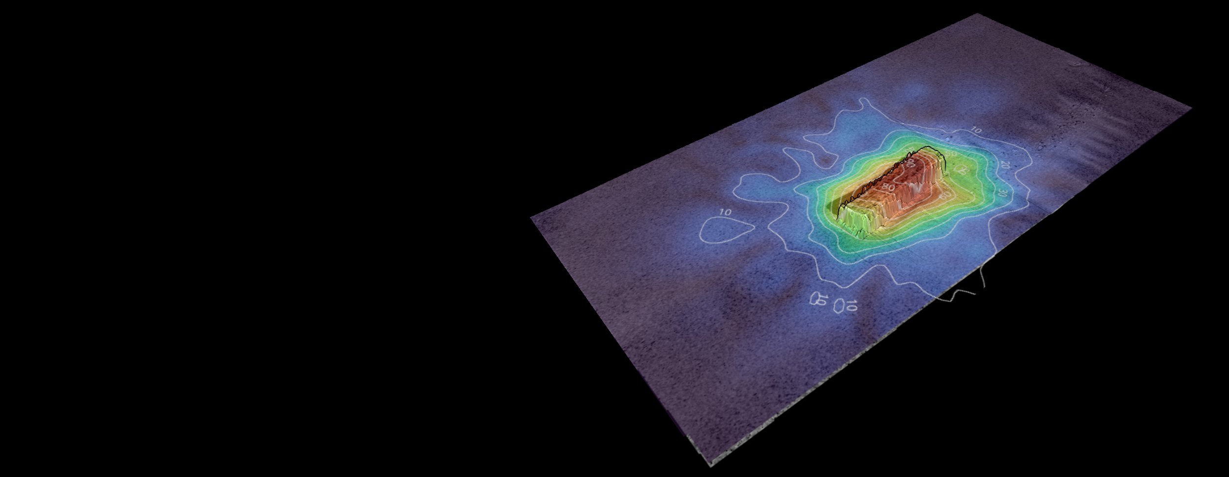
Our AUVS run at constant low altitude above the seafloor. This operational approach makes it possible to collect data at the highest resolution, meaning you get the information you need.
Minimized risk of environmental damage.
Smaller sonars close to the seafloor mean minimal to no sound harassment in Marine Protected Areas. In addition, at a speed of 2-3 knots, our AUVs have a low chance of animal or environmental damage as they’re transiting.
Survey operations with minimal weather impact.
Staying below the surface means we stay clear of adverse weather on the surface. Our vehicles can operate at close to 100% utilization.
Real time onboard QA/QC
We employ a custom proprietary method for onboard data evaluation and visualization from a single survey line to provide a basic QC image that is shared to the operator and interested stakeholders via starlink. This capability is crucial for near real-time data quality assessment and feature identification.

How it works
Plan
Our team plans comprehensive surveys in Mosaic, our proprietary mission planning software, based on specific customer data needs.
Operate
Our experienced crew of operators run a streamlined survey operation using our fleet of proprietary AUVs.
Validate
Our fleet of AUVs collects data and transmits back to the team in real-time for onboard validation.
Share
Once missions are complete, we upload data to our cloud-based platform Mosaic to share and distribute with clients.
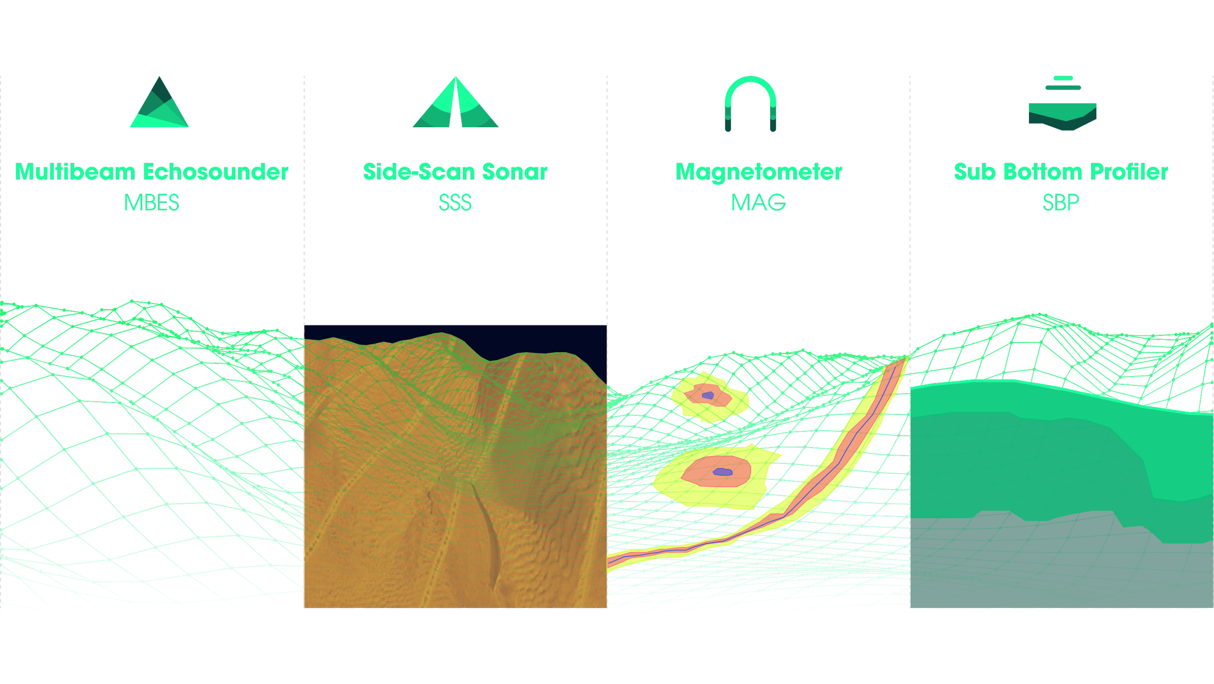
Datasets We Collect
View our full technical specifications here

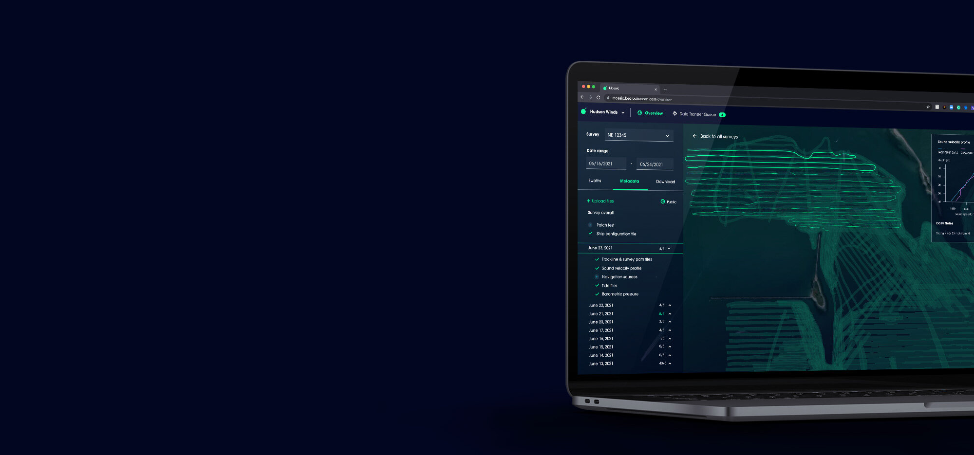
Cloud Data Management
We deliver all data through the cloud. Access to Mosaic, Bedrock’s data platform, is included in our survey services to maximize the value of your seafloor data and simplify data management.